 vesseltracker.com
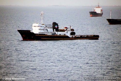
 Salvage Ace
Current Status
Where is the vessel?
Salvage Ace is currently in Near Go Dau B Terminal, based on AIS data received about 1h ago.
Latest AIS update:
Current position: 10.62194° N, 106.99577° E (Near Go Dau B Terminal)
Average speed (last 7 days): Loading…
Average speed (last 30 days): Loading…
Vessel profile: Salvage Ace is a Tug with dimensions 65m x 14m.
This page combines live AIS, route history, probable destination signals, nearby traffic, and port activity for practical vessel monitoring.
The current position of vessel Salvage Ace is 10.62194 lat / 106.99577 lng. Updated: 2026-04-28 00:07:27 UTCNearest reference points:
- Near Saigon ITV/Phu My
- Near Cai Mep International Terminal
- Near Nhon Trach
Currently sailing under the flag of St Vincent Grenadines ![]()
Salvage Ace built in 1976 year
Deadweight:
1741 tDetails:
Live Vessel Salvage Ace Analytics (details, animations, etc.)
Recent AIS points (UTC):
2026-04-27 20:21:44 UTC · 10.62193, 106.99577 · SOG 0 kn · COG 142°2026-04-27 21:42:15 UTC · 10.62190, 106.99576 · SOG 0 kn · COG 143°
2026-04-27 22:18:15 UTC · 10.62192, 106.99577 · SOG 0 kn · COG 142°
2026-04-28 00:07:27 UTC · 10.62194, 106.99577 · SOG 0 kn · COG 143°