 vesseltracker.com
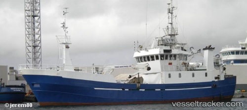
 COSTA DE AGUINO
Current Status
Where is the vessel?
COSTA DE AGUINO is currently in 41 nm SE of Praia, based on AIS data received about 1h ago.
Latest AIS update:
Current position: 14.41833° N, 23.00565° W (41 nm SE of Praia)
Average speed (last 7 days): Loading…
Average speed (last 30 days): Loading…
Vessel profile: COSTA DE AGUINO is a Fishing Vessel with dimensions m x m.
This page combines live AIS, route history, probable destination signals, nearby traffic, and port activity for practical vessel monitoring.
The current position of vessel COSTA DE AGUINO is 14.41833 lat / -23.00565 lng. Updated: 2026-04-30 23:41:14 UTCNearest reference points:
- Near Ilha do Sal
- 39 nm W of Ilha do Sal
Currently sailing under the flag of Cabo Verde ![]()
Details:
Live Vessel COSTA DE AGUINO Analytics (details, animations, etc.)
Recent AIS points (UTC):
2026-04-30 19:41:43 UTC · 14.66411, -23.34115 · SOG 8.3 kn · COG -1°2026-04-30 22:00:35 UTC · 14.47339, -23.07974 · SOG 8.6 kn · COG -1°
2026-04-30 22:47:13 UTC · 14.42477, -23.00423 · SOG 1.4 kn · COG -1°
2026-04-30 23:41:14 UTC · 14.41833, -23.00565 · SOG 0.1 kn · COG -1°