 vesseltracker.com
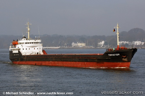
 PINDUSHI
Current Status
Where is the vessel?
PINDUSHI is currently in Near Nemrut Bay, based on AIS data received about 1h ago.
Latest AIS update:
Current position: 38.77301° N, 26.87191° E (Near Nemrut Bay)
Average speed (last 7 days): Loading…
Average speed (last 30 days): Loading…
Vessel profile: PINDUSHI is a General Cargo with dimensions 114m x 13m.
This page combines live AIS, route history, probable destination signals, nearby traffic, and port activity for practical vessel monitoring.
The current position of vessel PINDUSHI is 38.77301 lat / 26.87191 lng. Updated: 2026-05-14 07:25:29 UTCNearest reference points:
- Near Nemrut Bay
- Near NEMRUT
- Near Aliaga
Currently sailing under the flag of Russia ![]()
PINDUSHI built in 1977 year
Deadweight:
3550 tDetails:
Live Vessel PINDUSHI Analytics (details, animations, etc.)
Recent AIS points (UTC):
2026-05-14 05:04:28 UTC · 38.77312, 26.87210 · SOG 0 kn · COG -1°2026-05-14 05:58:29 UTC · 38.77293, 26.87196 · SOG 0 kn · COG -1°
2026-05-14 07:22:28 UTC · 38.77300, 26.87190 · SOG 0 kn · COG -1°
2026-05-14 07:25:29 UTC · 38.77301, 26.87191 · SOG 0 kn · COG -1°