 vesseltracker.com
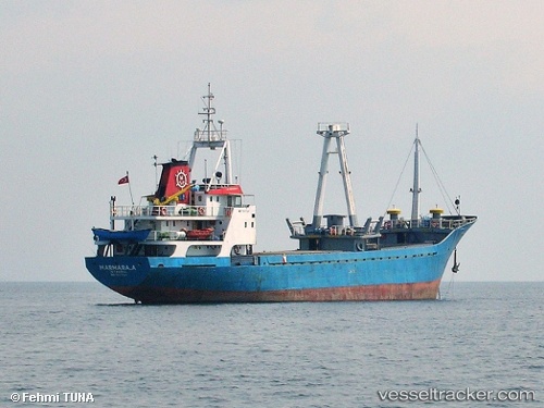
 Fahriye Ana
Current Status
Where is the vessel?
Fahriye Ana is currently in 11 nm NE of Gelibolu, based on AIS data received less than 1h ago.
Latest AIS update:
Current position: 40.49242° N, 26.86900° E (11 nm NE of Gelibolu)
Average speed (last 7 days): Loading…
Average speed (last 30 days): Loading…
Vessel profile: Fahriye Ana is a General Cargo Ship with dimensions 71m x 11m.
This page combines live AIS, route history, probable destination signals, nearby traffic, and port activity for practical vessel monitoring.
The current position of vessel Fahriye Ana is 40.49242 lat / 26.86900 lng. Updated: 2026-04-21 05:58:21 UTCNearest reference points:
- Near Sarköy
- Near Gelibolu
- Near Dardanelles
Currently sailing under the flag of Turkey ![]()
Fahriye Ana built in 1977 year
Deadweight:
1905 tDetails:
Live Vessel Fahriye Ana Analytics (details, animations, etc.)
Recent AIS points (UTC):
2026-04-20 17:50:00 UTC · 40.64634, 27.55662 · SOG 0 kn · COG -1°2026-04-20 17:50:00 UTC · 40.64634, 27.55662 · SOG 0 kn · COG -1°
2026-04-20 17:50:00 UTC · 40.64634, 27.55662 · SOG 0 kn · COG -1°
2026-04-21 05:58:21 UTC · 40.49242, 26.86900 · SOG 8 kn · COG -1°