 vesseltracker.com
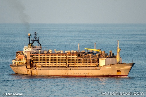
Aliman
Current StatusWhere is the vessel?
Aliman is currently in 245 nm E of Puerto Deseado, based on AIS data received less than 1h ago.
Latest AIS update:
Current position: 46.20734° S, 60.38261° W (245 nm E of Puerto Deseado)
Average speed (last 7 days): Loading…
Average speed (last 30 days): Loading…
Vessel profile: Aliman is a Livestock Carrier with dimensions 32m x 109m.
This page combines live AIS, route history, probable destination signals, nearby traffic, and port activity for practical vessel monitoring.
The current position of vessel Aliman is -46.20734 lat / -60.38261 lng. Updated: 2026-05-16 02:07:53 UTCDetails:
Live Vessel Aliman Analytics (details, animations, etc.)
Recent AIS points (UTC):
2026-05-15 22:50:00 UTC · -46.21715, -60.39208 · SOG 1 kn · COG -1°2026-05-16 00:15:07 UTC · -46.21613, -60.39025 · SOG 0.9 kn · COG -1°
2026-05-16 01:21:58 UTC · -46.21037, -60.38446 · SOG 2.6 kn · COG -1°
2026-05-16 02:07:53 UTC · -46.20734, -60.38261 · SOG 3 kn · COG -1°