 vesseltracker.com
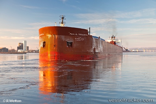
 Paul R Tregurtha
Current Status
Where is the vessel?
Paul R Tregurtha is currently in Near Proctor, based on AIS data received about 1h ago.
Latest AIS update:
Current position: 46.75206° N, 92.13583° W (Near Proctor)
Average speed (last 7 days): Loading…
Average speed (last 30 days): Loading…
Vessel profile: Paul R Tregurtha is a Self Discharging Bulk Carrier with dimensions 309m x 32m.
This page combines live AIS, route history, probable destination signals, nearby traffic, and port activity for practical vessel monitoring.
The current position of vessel Paul R Tregurtha is 46.75206 lat / -92.13583 lng. Updated: 2026-05-13 22:52:55 UTCNearest reference points:
- Near La Pointe
Currently sailing under the flag of USA ![]()
Paul R Tregurtha built in 1981 year
Deadweight:
69172 tDetails:
Live Vessel Paul R Tregurtha Analytics (details, animations, etc.)
Recent AIS points (UTC):
2026-05-13 19:29:52 UTC · 46.75210, -92.13585 · SOG 0 kn · COG 137°2026-05-13 20:22:55 UTC · 46.75210, -92.13585 · SOG 0 kn · COG 137°
2026-05-13 21:43:54 UTC · 46.75212, -92.13582 · SOG 0 kn · COG 137°
2026-05-13 22:52:55 UTC · 46.75206, -92.13583 · SOG 0 kn · COG 137°