 vesseltracker.com
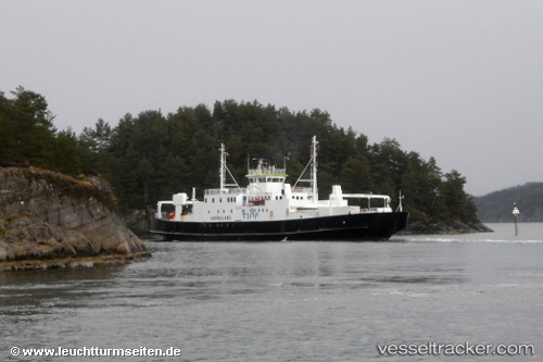
 Hordaland
Current Status
Where is the vessel?
Hordaland is currently in Near Erfjord - Suldal, based on AIS data received less than 1h ago.
Latest AIS update:
Current position: 59.33961° N, 6.22863° E (Near Erfjord - Suldal)
Average speed (last 7 days): Loading…
Average speed (last 30 days): Loading…
Vessel profile: Hordaland is a Passenger Ro Ro Cargo Ship with dimensions 74m x 14m.
This page combines live AIS, route history, probable destination signals, nearby traffic, and port activity for practical vessel monitoring.
The current position of vessel Hordaland is 59.33961 lat / 6.22863 lng. Updated: 2026-05-15 01:14:38 UTCNearest reference points:
- Near Lura
- Near Halsnøy
- Near ROSENDAL
Currently sailing under the flag of Norway ![]()
Hordaland built in 1979 year
Deadweight:
150 tDetails:
Live Vessel Hordaland Analytics (details, animations, etc.)
Recent AIS points (UTC):
2026-05-14 21:59:04 UTC · 59.33964, 6.22870 · SOG 0 kn · COG 123°2026-05-14 22:34:49 UTC · 59.33964, 6.22861 · SOG 0 kn · COG 123°
2026-05-14 23:58:54 UTC · 59.33957, 6.22863 · SOG 0 kn · COG 123°
2026-05-15 01:14:38 UTC · 59.33961, 6.22863 · SOG 0 kn · COG 123°