 vesseltracker.com
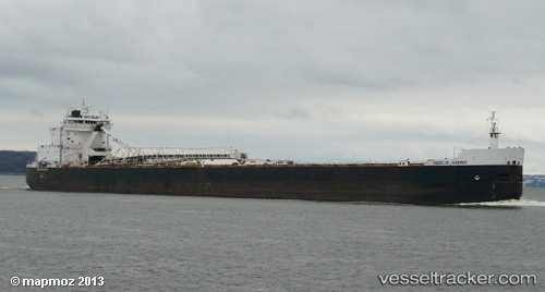
 American Mariner
Current Status
Where is the vessel?
American Mariner is currently in Near Melvindale, based on AIS data received less than 1h ago.
Latest AIS update:
Current position: 42.18548° N, 83.13488° W (Near Melvindale)
Average speed (last 7 days): Loading…
Average speed (last 30 days): Loading…
Vessel profile: American Mariner is a Self Discharging Bulk Carrier with dimensions 222m x 23m.
This page combines live AIS, route history, probable destination signals, nearby traffic, and port activity for practical vessel monitoring.
The current position of vessel American Mariner is 42.18548 lat / -83.13488 lng. Updated: 2026-04-25 16:04:09 UTCNearest reference points:
- Near Walkerville
- Near Saint Clair Shores
- Near Put-In-Bay
Currently sailing under the flag of USA ![]()
American Mariner built in 1980 year
Deadweight:
36171 tDetails:
Live Vessel American Mariner Analytics (details, animations, etc.)
Recent AIS points (UTC):
2026-04-25 13:45:28 UTC · 42.44858, -82.77633 · SOG 12.2 kn · COG -1°2026-04-25 14:06:48 UTC · 42.39998, -82.84820 · SOG 12 kn · COG -1°
2026-04-25 15:52:39 UTC · 42.21805, -83.13124 · SOG 10.6 kn · COG -1°
2026-04-25 16:04:09 UTC · 42.18548, -83.13488 · SOG 9.8 kn · COG -1°