 vesseltracker.com
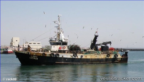
Lucimar
Current StatusWhere is the vessel?
Lucimar is currently in 40 nm SW of Mocamedes, based on AIS data received less than 1h ago.
Latest AIS update:
Current position: 15.80167° S, 11.84500° E (40 nm SW of Mocamedes)
Average speed (last 7 days): Loading…
Average speed (last 30 days): Loading…
Vessel profile: Lucimar is a Fishing Vessel with dimensions 8m x 34m.
This page combines live AIS, route history, probable destination signals, nearby traffic, and port activity for practical vessel monitoring.
The current position of vessel Lucimar is -15.80167 lat / 11.84500 lng. Updated: 2026-05-14 03:41:49 UTCDetails:
Live Vessel Lucimar Analytics (details, animations, etc.)
Recent AIS points (UTC):
2026-05-13 23:48:49 UTC · -15.80192, 11.84641 · SOG 0 kn · COG -1°2026-05-14 01:17:50 UTC · -15.80167, 11.84500 · SOG 0 kn · COG -1°
2026-05-14 01:26:52 UTC · -15.80167, 11.84500 · SOG 0 kn · COG -1°
2026-05-14 03:41:49 UTC · -15.80167, 11.84500 · SOG 0 kn · COG -1°