 vesseltracker.com
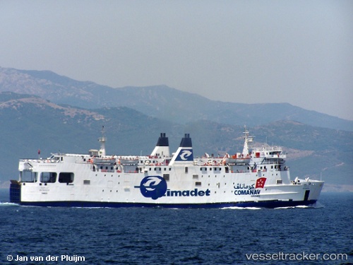
European Star
Current StatusWhere is the vessel?
European Star is currently in Near Porto Di Brindisi, based on AIS data received less than 1h ago.
Latest AIS update:
Current position: 40.64815° N, 17.96207° E (Near Porto Di Brindisi)
Average speed (last 7 days): Loading…
Average speed (last 30 days): Loading…
Vessel profile: European Star is a Passenger Ro Ro Cargo Ship with dimensions 37m x 113m.
This page combines live AIS, route history, probable destination signals, nearby traffic, and port activity for practical vessel monitoring.
The current position of vessel European Star is 40.64815 lat / 17.96207 lng. Updated: 2026-05-15 10:14:39 UTCNearest reference points:
- Near Porto Di Brindisi
- Near Monopoli
- 11 nm S of Leuca
Details:
Live Vessel European Star Analytics (details, animations, etc.)
Recent AIS points (UTC):
2026-05-15 07:09:22 UTC · 40.64815, 17.96207 · SOG 0 kn · COG 344°2026-05-15 07:38:49 UTC · 40.64816, 17.96206 · SOG 0 kn · COG 345°
2026-05-15 10:00:36 UTC · 40.64813, 17.96206 · SOG 0 kn · COG 345°
2026-05-15 10:14:39 UTC · 40.64815, 17.96207 · SOG 0 kn · COG 345°