 vesseltracker.com
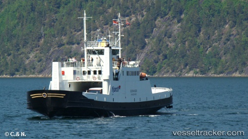
 Geiranger
Current Status
Where is the vessel?
Geiranger is currently in Near Standal, based on AIS data received about 1h ago.
Latest AIS update:
Current position: 62.21133° N, 6.47664° E (Near Standal)
Average speed (last 7 days): Loading…
Average speed (last 30 days): Loading…
Vessel profile: Geiranger is a Passenger Ro Ro Cargo Ship with dimensions 64m x 12m.
This page combines live AIS, route history, probable destination signals, nearby traffic, and port activity for practical vessel monitoring.
The current position of vessel Geiranger is 62.21133 lat / 6.47664 lng. Updated: 2026-05-15 17:50:30 UTCNearest reference points:
- Near Fiskarstrand
- Near SPJELKAVIK
- Near Alesund
Currently sailing under the flag of Norway ![]()
Details:
Live Vessel Geiranger Analytics (details, animations, etc.)
Recent AIS points (UTC):
2026-05-15 13:31:33 UTC · 62.21124, 6.47658 · SOG 0 kn · COG 231°2026-05-15 15:34:30 UTC · 62.21014, 6.49695 · SOG 10.4 kn · COG 105°
2026-05-15 16:41:56 UTC · 62.20527, 6.53334 · SOG 2.8 kn · COG 49°
2026-05-15 17:50:30 UTC · 62.21133, 6.47664 · SOG 0 kn · COG 230°