 vesseltracker.com
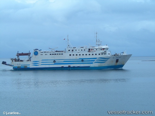
Isla Tenglo
Current StatusWhere is the vessel?
Isla Tenglo is currently in Near Puerto Montt, based on AIS data received less than 1h ago.
Latest AIS update:
Current position: 41.50377° S, 72.99419° W (Near Puerto Montt)
Average speed (last 7 days): Loading…
Average speed (last 30 days): Loading…
Vessel profile: Isla Tenglo is a Passenger Ro Ro Cargo Ship with dimensions 14m x 66m.
This page combines live AIS, route history, probable destination signals, nearby traffic, and port activity for practical vessel monitoring.
The current position of vessel Isla Tenglo is -41.50377 lat / -72.99419 lng. Updated: 2026-05-14 04:09:42 UTCNearest reference points:
- Near Puerto Montt
- Near Chonchi
- Near Quellón (Puerto Quellón)
Details:
Live Vessel Isla Tenglo Analytics (details, animations, etc.)
Recent AIS points (UTC):
2026-05-14 00:15:26 UTC · -41.50377, -72.99421 · SOG 0 kn · COG 316°2026-05-14 01:39:32 UTC · -41.50377, -72.99421 · SOG 0 kn · COG 318°
2026-05-14 02:09:24 UTC · -41.50376, -72.99419 · SOG 0 kn · COG 317°
2026-05-14 04:09:42 UTC · -41.50377, -72.99419 · SOG 0 kn · COG 317°