 vesseltracker.com
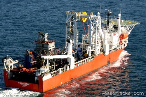
The Explorer
Current StatusWhere is the vessel?
The Explorer is currently in Near Salt River, based on AIS data received about 2h ago.
Latest AIS update:
Current position: 33.91478° S, 18.45394° E (Near Salt River)
Average speed (last 7 days): Loading…
Average speed (last 30 days): Loading…
Vessel profile: The Explorer is a Offshore Support Vessel with dimensions 20m x 131m.
This page combines live AIS, route history, probable destination signals, nearby traffic, and port activity for practical vessel monitoring.
The current position of vessel The Explorer is -33.91478 lat / 18.45394 lng. Updated: 2026-05-15 01:14:41 UTCNearest reference points:
- Near Salt River
- Near Ben Schoeman Dock
- Near Cape Town
Details:
Live Vessel The Explorer Analytics (details, animations, etc.)
Recent AIS points (UTC):
2026-05-14 21:59:35 UTC · -33.91480, 18.45392 · SOG 0 kn · COG 315°2026-05-14 22:32:38 UTC · -33.91482, 18.45403 · SOG 0 kn · COG 315°
2026-05-14 23:56:44 UTC · -33.91480, 18.45404 · SOG 0 kn · COG 315°
2026-05-15 01:14:41 UTC · -33.91478, 18.45394 · SOG 0 kn · COG 315°