 vesseltracker.com
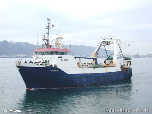
Friosur X
Current StatusWhere is the vessel?
Friosur X is currently in 45 nm W of Guaitecas, based on AIS data received about 9h ago.
Latest AIS update:
Current position: 43.83426° S, 74.93966° W (45 nm W of Guaitecas)
Average speed (last 7 days): Loading…
Average speed (last 30 days): Loading…
Vessel profile: Friosur X is a Fishing Vessel with dimensions 12m x 50m.
This page combines live AIS, route history, probable destination signals, nearby traffic, and port activity for practical vessel monitoring.
The current position of vessel Friosur X is -43.83426 lat / -74.93966 lng. Updated: 2026-05-13 15:48:40 UTCNearest reference points:
- Near Melinka
- Near Quellón (Puerto Quellón)
- Near Chonchi
Details:
Live Vessel Friosur X Analytics (details, animations, etc.)
Recent AIS points (UTC):
2026-05-13 15:48:40 UTC · -43.83426, -74.93966 · SOG 3.6 kn · COG -1°2026-05-13 15:48:40 UTC · -43.83426, -74.93966 · SOG 3.6 kn · COG -1°
2026-05-13 15:48:40 UTC · -43.83426, -74.93966 · SOG 3.6 kn · COG -1°
2026-05-13 15:48:40 UTC · -43.83426, -74.93966 · SOG 3.6 kn · COG -1°