 vesseltracker.com
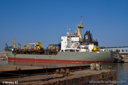
 Stuyvesant
Current Status
Where is the vessel?
Stuyvesant is currently in Near Mayport, based on AIS data received less than 1h ago.
Latest AIS update:
Current position: 30.38802° N, 81.45759° W (Near Mayport)
Average speed (last 7 days): Loading…
Average speed (last 30 days): Loading…
Vessel profile: Stuyvesant is a Hopper Dredger with dimensions 122m x 22m.
This page combines live AIS, route history, probable destination signals, nearby traffic, and port activity for practical vessel monitoring.
The current position of vessel Stuyvesant is 30.38802 lat / -81.45759 lng. Updated: 2026-05-14 19:47:08 UTCNearest reference points:
- Near Jacksonville
- Near Ponte Vedra
- Near Fernandina
Currently sailing under the flag of USA ![]()
Stuyvesant built in 1982 year
Deadweight:
9950 tDetails:
Live Vessel Stuyvesant Analytics (details, animations, etc.)
Recent AIS points (UTC):
2026-05-14 16:50:09 UTC · 30.38805, -81.45759 · SOG 0 kn · COG 193°2026-05-14 18:05:06 UTC · 30.38805, -81.45762 · SOG 0 kn · COG 193°
2026-05-14 19:35:12 UTC · 30.38806, -81.45757 · SOG 0 kn · COG 193°
2026-05-14 19:47:08 UTC · 30.38802, -81.45759 · SOG 0 kn · COG 193°