 vesseltracker.com
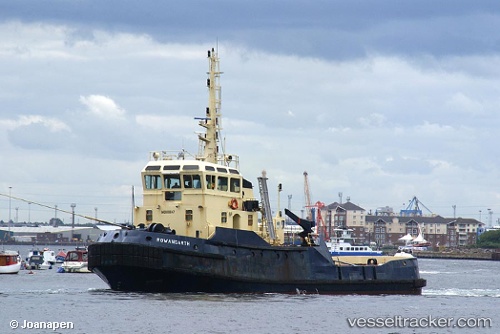
 Rowangarth
Current Status
Where is the vessel?
Rowangarth is currently in Near Mykolaiv, based on AIS data received about 591d ago.
Latest AIS update:
Current position: 46.94682° N, 31.99158° E (Near Mykolaiv)
Average speed (last 7 days): Loading…
Average speed (last 30 days): Loading…
Vessel profile: Rowangarth is a Tug with dimensions 32m x 10m.
This page combines live AIS, route history, probable destination signals, nearby traffic, and port activity for practical vessel monitoring.
The current position of vessel Rowangarth is 46.94682 lat / 31.99158 lng. Updated: 2024-09-30 08:11:30 UTCNearest reference points:
- Near Olviia
- 45 nm W of Krasne
- Near Illichivs’K
Currently sailing under the flag of Ukraine ![]()
Rowangarth built in 1981 year
Deadweight:
173 tDetails:
Live Vessel Rowangarth Analytics (details, animations, etc.)
Recent AIS points (UTC):
2024-09-30 08:11:30 UTC · 46.94682, 31.99158 · SOG 0 kn · COG 121°