 vesseltracker.com
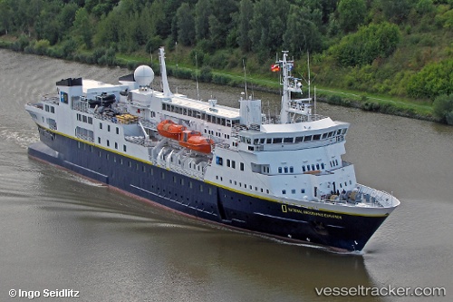
 N G Explorer
Current Status
Where is the vessel?
N G Explorer is currently in Near Fastnet Rock, based on AIS data received about 1h ago.
Latest AIS update:
Current position: 51.38118° N, 9.41738° W (Near Fastnet Rock)
Average speed (last 7 days): Loading…
Average speed (last 30 days): Loading…
Vessel profile: N G Explorer is a Cruise Ship with dimensions 112m x 16m.
This page combines live AIS, route history, probable destination signals, nearby traffic, and port activity for practical vessel monitoring.
The current position of vessel N G Explorer is 51.38118 lat / -9.41738 lng. Updated: 2026-04-30 01:46:22 UTCNearest reference points:
- Near Skull
- Near CASTLETOWN BEARHAVEN
- Near Tarbert Island
Currently sailing under the flag of Bahamas ![]()
N G Explorer built in 1982 year
Deadweight:
1301 tDetails:
Live Vessel N G Explorer Analytics (details, animations, etc.)
Recent AIS points (UTC):
2026-04-29 22:32:12 UTC · 51.52836, -8.62000 · SOG 12.1 kn · COG 250°2026-04-29 23:46:41 UTC · 51.46126, -8.96730 · SOG 9.5 kn · COG 251°
2026-04-30 01:03:52 UTC · 51.40937, -9.25677 · SOG 8.9 kn · COG 253°
2026-04-30 01:46:22 UTC · 51.38118, -9.41738 · SOG 9 kn · COG 253°