 vesseltracker.com
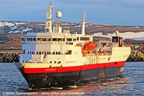
Vesteraalen
Current StatusWhere is the vessel?
Vesteraalen is currently in 12 nm S of Stamsund, based on AIS data received less than 1h ago.
Latest AIS update:
Current position: 67.92243° N, 14.00922° E (12 nm S of Stamsund)
Average speed (last 7 days): Loading…
Average speed (last 30 days): Loading…
Vessel profile: Vesteraalen is a Passenger General Cargo Ship with dimensions 16m x 108m.
This page combines live AIS, route history, probable destination signals, nearby traffic, and port activity for practical vessel monitoring.
The current position of vessel Vesteraalen is 67.92243 lat / 14.00922 lng. Updated: 2026-04-19 16:21:40 UTCNearest reference points:
- Near SVOLVAER
- Near Misten
- Near Berrvik (Bergvik)
Details:
Live Vessel Vesteraalen Analytics (details, animations, etc.)
Recent AIS points (UTC):
2026-04-19 12:24:38 UTC · 67.28897, 14.39528 · SOG 0 kn · COG 204°2026-04-19 13:58:46 UTC · 67.35036, 14.39223 · SOG 14.8 kn · COG 23°
2026-04-19 14:00:10 UTC · 67.35575, 14.39789 · SOG 14.9 kn · COG 23°
2026-04-19 16:21:40 UTC · 67.92243, 14.00922 · SOG 16 kn · COG 342°