 vesseltracker.com
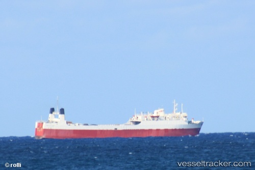
Tropic Opal
Current StatusWhere is the vessel?
Tropic Opal is currently in 38 nm NW of West End, based on AIS data received about 4h ago.
Latest AIS update:
Current position: 27.22343° N, 79.33155° W (38 nm NW of West End)
Average speed (last 7 days): Loading…
Average speed (last 30 days): Loading…
Vessel profile: Tropic Opal is a Deck Cargo Ship with dimensions 19m x 82m.
This page combines live AIS, route history, probable destination signals, nearby traffic, and port activity for practical vessel monitoring.
The current position of vessel Tropic Opal is 27.22343 lat / -79.33155 lng. Updated: 2026-05-14 08:54:45 UTCNearest reference points:
- Near Juno Beach
- Near North Palm Beach
- Near Lake Park
Details:
Live Vessel Tropic Opal Analytics (details, animations, etc.)
Recent AIS points (UTC):
2026-05-14 05:41:13 UTC · 27.42267, -78.78986 · SOG 10.5 kn · COG 209°2026-05-14 08:54:45 UTC · 27.22343, -79.33155 · SOG 9.8 kn · COG 171°
2026-05-14 08:54:45 UTC · 27.22343, -79.33155 · SOG 9.8 kn · COG 171°
2026-05-14 08:54:45 UTC · 27.22343, -79.33155 · SOG 9.8 kn · COG 171°