 vesseltracker.com
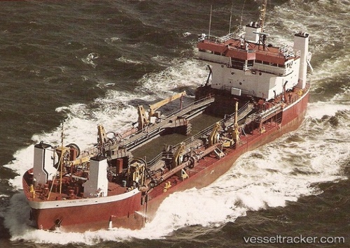
Padre Island
Current StatusWhere is the vessel?
Padre Island is currently in Near Palm Beach, based on AIS data received less than 1h ago.
Latest AIS update:
Current position: 26.75238° N, 80.02252° W (Near Palm Beach)
Average speed (last 7 days): Loading…
Average speed (last 30 days): Loading…
Vessel profile: Padre Island is a Hopper Dredger with dimensions 16m x 86m.
This page combines live AIS, route history, probable destination signals, nearby traffic, and port activity for practical vessel monitoring.
The current position of vessel Padre Island is 26.75238 lat / -80.02252 lng. Updated: 2026-05-14 19:46:46 UTCNearest reference points:
- Near Rivera Beach
- Near Palm Beach
- Near Lake Park
Details:
Live Vessel Padre Island Analytics (details, animations, etc.)
Recent AIS points (UTC):
2026-05-14 16:50:56 UTC · 26.77659, -80.02540 · SOG 2.2 kn · COG 244°2026-05-14 18:05:05 UTC · 26.75768, -80.01986 · SOG 0.9 kn · COG 179°
2026-05-14 19:37:57 UTC · 26.75181, -80.02286 · SOG 0.2 kn · COG 87°
2026-05-14 19:46:46 UTC · 26.75238, -80.02252 · SOG 0.3 kn · COG 87°