 vesseltracker.com
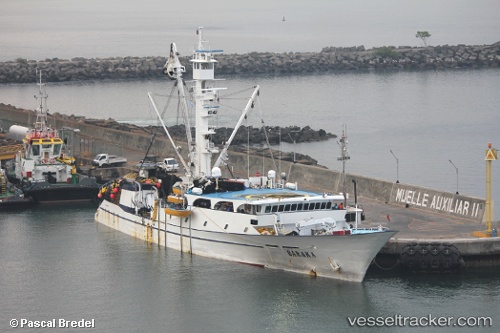
Baraka
Current StatusWhere is the vessel?
Baraka is currently in Near El Porvenir, based on AIS data received about 1h ago.
Latest AIS update:
Current position: 8.20416° N, 82.87326° W (Near El Porvenir)
Average speed (last 7 days): Loading…
Average speed (last 30 days): Loading…
Vessel profile: Baraka is a Fishing Vessel with dimensions 12m x 70m.
This page combines live AIS, route history, probable destination signals, nearby traffic, and port activity for practical vessel monitoring.
The current position of vessel Baraka is 8.20416 lat / -82.87326 lng. Updated: 2026-05-14 14:12:51 UTCNearest reference points:
- Near Chiriquí Grande
- 20 nm S of El Puerto
Details:
Live Vessel Baraka Analytics (details, animations, etc.)
Recent AIS points (UTC):
2026-05-14 10:28:00 UTC · 8.20333, -82.86833 · SOG 0 kn · COG -1°2026-05-14 11:27:43 UTC · 8.20352, -82.86943 · SOG 0 kn · COG 59°
2026-05-14 13:37:04 UTC · 8.20333, -82.87167 · SOG 0 kn · COG -1°
2026-05-14 14:12:51 UTC · 8.20416, -82.87326 · SOG 0 kn · COG 274°