 vesseltracker.com
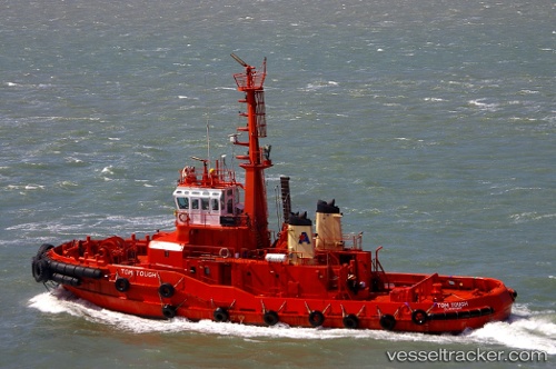
 AILAN TOUGH
Current Status
Where is the vessel?
AILAN TOUGH is currently in Near Lae, based on AIS data received about 1h ago.
Latest AIS update:
Current position: 6.74243° S, 146.98676° E (Near Lae)
Average speed (last 7 days): Loading…
Average speed (last 30 days): Loading…
Vessel profile: AILAN TOUGH is a Tug with dimensions m x m.
This page combines live AIS, route history, probable destination signals, nearby traffic, and port activity for practical vessel monitoring.
The current position of vessel AILAN TOUGH is -6.74243 lat / 146.98676 lng. Updated: 2026-05-14 07:45:34 UTCNearest reference points:
- Near Lae
- 42 nm E of Tami Island
Currently sailing under the flag of Vanuatu ![]()
Details:
Live Vessel AILAN TOUGH Analytics (details, animations, etc.)
Recent AIS points (UTC):
2026-05-14 04:23:36 UTC · -6.74245, 146.98676 · SOG 0.6 kn · COG -1°2026-05-14 06:18:54 UTC · -6.74253, 146.98672 · SOG 0.6 kn · COG -1°
2026-05-14 07:40:35 UTC · -6.74247, 146.98676 · SOG 0.1 kn · COG -1°
2026-05-14 07:45:34 UTC · -6.74243, 146.98676 · SOG 0.4 kn · COG -1°