 vesseltracker.com
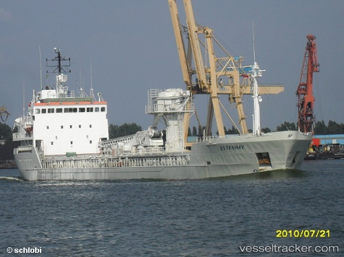
 TAMNON
Current Status
Where is the vessel?
TAMNON is currently in Near Ashdod Bonded, based on AIS data received less than 1h ago.
Latest AIS update:
Current position: 31.82928° N, 34.64356° E (Near Ashdod Bonded)
Average speed (last 7 days): Loading…
Average speed (last 30 days): Loading…
Vessel profile: TAMNON is a General Cargo with dimensions m x m.
This page combines live AIS, route history, probable destination signals, nearby traffic, and port activity for practical vessel monitoring.
The current position of vessel TAMNON is 31.82928 lat / 34.64356 lng. Updated: 2026-05-15 13:39:37 UTCNearest reference points:
- Near AL ARISH
- Near Haifa
- 22 nm W of Haifa Granaries
Currently sailing under the flag of Saint Kitts and Nevis ![]()
Details:
Live Vessel TAMNON Analytics (details, animations, etc.)
Recent AIS points (UTC):
2026-05-15 09:41:22 UTC · 31.82925, 34.64360 · SOG 0 kn · COG 116°2026-05-15 10:27:51 UTC · 31.82924, 34.64358 · SOG 0 kn · COG 116°
2026-05-15 11:42:50 UTC · 31.82927, 34.64359 · SOG 0 kn · COG 115°
2026-05-15 13:39:37 UTC · 31.82928, 34.64356 · SOG 0 kn · COG 116°