 vesseltracker.com
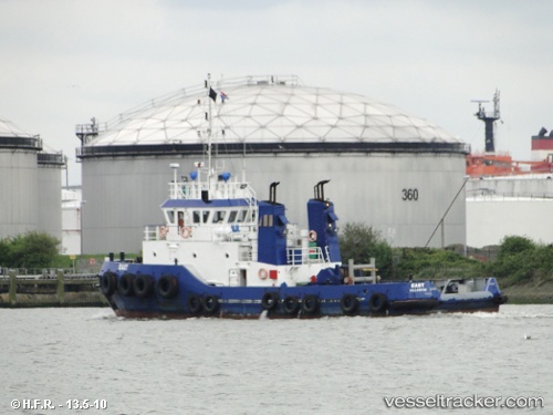
 East Coast
Current Status
Where is the vessel?
East Coast is currently in Near South Baltimore, based on AIS data received about 3h ago.
Latest AIS update:
Current position: 39.27559° N, 76.59478° W (Near South Baltimore)
Average speed (last 7 days): Loading…
Average speed (last 30 days): Loading…
Vessel profile: East Coast is a Tug with dimensions 34m x 34m.
This page combines live AIS, route history, probable destination signals, nearby traffic, and port activity for practical vessel monitoring.
The current position of vessel East Coast is 39.27559 lat / -76.59478 lng. Updated: 2026-05-14 23:32:57 UTCNearest reference points:
- Near Baltimore
- Near South Baltimore
- Near DUNDALK
Currently sailing under the flag of USA ![]()
Details:
Live Vessel East Coast Analytics (details, animations, etc.)
Recent AIS points (UTC):
2026-05-14 19:48:07 UTC · 39.27560, -76.59477 · SOG 0 kn · COG 244°2026-05-14 21:48:56 UTC · 39.27561, -76.59478 · SOG 0.1 kn · COG 244°
2026-05-14 23:10:37 UTC · 39.27559, -76.59479 · SOG 0 kn · COG 243°
2026-05-14 23:32:57 UTC · 39.27559, -76.59478 · SOG 0 kn · COG 245°