 vesseltracker.com
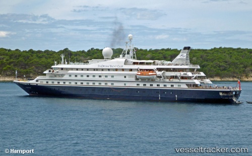
 Seadream Ii
Current Status
Where is the vessel?
Seadream Ii is currently in Near GUERNSEY, based on AIS data received less than 1h ago.
Latest AIS update:
Current position: 49.45673° N, 2.52976° W (Near GUERNSEY)
Average speed (last 7 days): Loading…
Average speed (last 30 days): Loading…
Vessel profile: Seadream Ii is a Cruise Ship with dimensions 105m x 18m.
This page combines live AIS, route history, probable destination signals, nearby traffic, and port activity for practical vessel monitoring.
The current position of vessel Seadream Ii is 49.45673 lat / -2.52976 lng. Updated: 2026-05-14 22:56:39 UTCNearest reference points:
- Near GUERNSEY
- Near SAINT SAMPSON
- Near Saint Sampson
Currently sailing under the flag of Bahamas ![]()
Seadream Ii built in 1985 year
Deadweight:
450 tDetails:
Live Vessel Seadream Ii Analytics (details, animations, etc.)
Recent AIS points (UTC):
2026-05-14 19:08:11 UTC · 49.45673, -2.52977 · SOG 0 kn · COG 159°2026-05-14 19:49:43 UTC · 49.45672, -2.52976 · SOG 0 kn · COG 159°
2026-05-14 22:24:01 UTC · 49.45673, -2.52976 · SOG 0 kn · COG 159°
2026-05-14 22:56:39 UTC · 49.45673, -2.52976 · SOG 0 kn · COG 159°