 vesseltracker.com
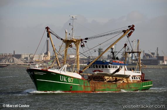
 Uk87 Maria
Current Status
Where is the vessel?
Uk87 Maria is currently in Near Zhangzhou Pt, based on AIS data received about 9d ago.
Latest AIS update:
Current position: 24.54012° N, 117.73691° E (Near Zhangzhou Pt)
Average speed (last 7 days): Loading…
Average speed (last 30 days): Loading…
Vessel profile: Uk87 Maria is a Fishing Vessel with dimensions 40m x 40m.
This page combines live AIS, route history, probable destination signals, nearby traffic, and port activity for practical vessel monitoring.
The current position of vessel Uk87 Maria is 24.54012 lat / 117.73691 lng. Updated: 2026-05-05 03:51:51 UTCNearest reference points:
- Near Zhangzhou Pt
- Near LONGHAI
- Near Haicang
Currently sailing under the flag of Netherlands ![]()
Uk87 Maria built in 1983 year
Details:
Live Vessel Uk87 Maria Analytics (details, animations, etc.)
Recent AIS points (UTC):
2026-05-05 03:51:51 UTC · 24.54012, 117.73691 · SOG 0 kn · COG -1°2026-05-05 03:51:51 UTC · 24.54012, 117.73691 · SOG 0 kn · COG -1°
2026-05-05 03:51:51 UTC · 24.54012, 117.73691 · SOG 0 kn · COG -1°
2026-05-05 03:51:51 UTC · 24.54012, 117.73691 · SOG 0 kn · COG -1°
2026-05-05 03:51:51 UTC · 24.54012, 117.73691 · SOG 0 kn · COG -1°