 vesseltracker.com
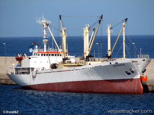
Rangiroa
Current StatusWhere is the vessel?
Rangiroa is currently in 49 nm S of Grand-Béréby, based on AIS data received about 1h ago.
Latest AIS update:
Current position: 3.84739° N, 7.02116° W (49 nm S of Grand-Béréby)
Average speed (last 7 days): Loading…
Average speed (last 30 days): Loading…
Vessel profile: Rangiroa is a Fish Carrier with dimensions 16m x 92m.
This page combines live AIS, route history, probable destination signals, nearby traffic, and port activity for practical vessel monitoring.
The current position of vessel Rangiroa is 3.84739 lat / -7.02116 lng. Updated: 2026-04-23 19:49:44 UTCNearest reference points:
- 98 nm SW of Harper
- 160 nm S of Harper
Details:
Live Vessel Rangiroa Analytics (details, animations, etc.)
Recent AIS points (UTC):
2026-04-23 16:31:35 UTC · 3.75926, -6.49559 · SOG 9.8 kn · COG 344°2026-04-23 17:12:43 UTC · 3.77660, -6.60659 · SOG 9.8 kn · COG 270°
2026-04-23 19:43:59 UTC · 3.84301, -7.00594 · SOG 9.5 kn · COG 279°
2026-04-23 19:49:44 UTC · 3.84739, -7.02116 · SOG 9.6 kn · COG 279°