 vesseltracker.com
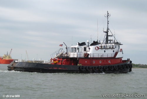
Crosby Trojan
Current StatusWhere is the vessel?
Crosby Trojan is currently in 54 nm NW of Gulfmex Lightering Area, based on AIS data received less than 1h ago.
Latest AIS update:
Current position: 28.44667° N, 91.47500° W (54 nm NW of Gulfmex Lightering Area)
Average speed (last 7 days): Loading…
Average speed (last 30 days): Loading…
Vessel profile: Crosby Trojan is a Tug with dimensions 10m x 34m.
This page combines live AIS, route history, probable destination signals, nearby traffic, and port activity for practical vessel monitoring.
The current position of vessel Crosby Trojan is 28.44667 lat / -91.47500 lng. Updated: 2026-05-16 11:22:31 UTCNearest reference points:
- 66 nm NW of Gulfmex Lightering Area
- 83 nm W of Gulfmex Lightering Area
- Near Amelia
Details:
Live Vessel Crosby Trojan Analytics (details, animations, etc.)
Recent AIS points (UTC):
2026-05-16 07:40:31 UTC · 28.45500, -91.48833 · SOG 0 kn · COG -1°2026-05-16 10:19:30 UTC · 28.44833, -91.47667 · SOG 0 kn · COG -1°
2026-05-16 10:57:09 UTC · 28.44680, -91.47808 · SOG 6.2 kn · COG -1°
2026-05-16 11:22:31 UTC · 28.44667, -91.47500 · SOG 0 kn · COG -1°