 vesseltracker.com
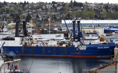
 Coastal Nomad
Current Status
Where is the vessel?
Coastal Nomad is currently in 23 nm E of Lenard Harbour, based on AIS data received about 1h ago.
Latest AIS update:
Current position: 55.23347° N, 161.77869° W (23 nm E of Lenard Harbour)
Average speed (last 7 days): Loading…
Average speed (last 30 days): Loading…
Vessel profile: Coastal Nomad is a General Cargo Ship with dimensions 74m x 74m.
This page combines live AIS, route history, probable destination signals, nearby traffic, and port activity for practical vessel monitoring.
The current position of vessel Coastal Nomad is 55.23347 lat / -161.77869 lng. Updated: 2026-05-01 05:45:31 UTCNearest reference points:
- Near Lenard Harbour
Currently sailing under the flag of USA ![]()
Coastal Nomad built in 1983 year
Deadweight:
2881 tDetails:
Live Vessel Coastal Nomad Analytics (details, animations, etc.)
Recent AIS points (UTC):
2026-05-01 01:41:44 UTC · 55.40684, -160.53615 · SOG 12.2 kn · COG 296°2026-05-01 03:56:40 UTC · 55.32953, -161.17313 · SOG 12.2 kn · COG 254°
2026-05-01 05:08:23 UTC · 55.29653, -161.59222 · SOG 12.2 kn · COG 261°
2026-05-01 05:45:31 UTC · 55.23347, -161.77869 · SOG 11.8 kn · COG 235°