 vesseltracker.com
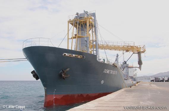
 Demetrios B
Current Status
Where is the vessel?
Demetrios B is currently in Near Thessaloniki, based on AIS data received about 1h ago.
Latest AIS update:
Current position: 40.63680° N, 22.92713° E (Near Thessaloniki)
Average speed (last 7 days): Loading…
Average speed (last 30 days): Loading…
Vessel profile: Demetrios B is a Cement Carrier with dimensions 200m x 16m.
This page combines live AIS, route history, probable destination signals, nearby traffic, and port activity for practical vessel monitoring.
The current position of vessel Demetrios B is 40.63680 lat / 22.92713 lng. Updated: 2026-05-14 13:52:14 UTCNearest reference points:
- Near Ammoulianí
- Near Agriá
- Near Volos
Currently sailing under the flag of Malta ![]()
Demetrios B built in 1983 year
Deadweight:
5734 tDetails:
Live Vessel Demetrios B Analytics (details, animations, etc.)
Recent AIS points (UTC):
2026-05-14 10:04:14 UTC · 40.63683, 22.92707 · SOG 0 kn · COG 273°2026-05-14 12:13:14 UTC · 40.63679, 22.92711 · SOG 0 kn · COG 273°
2026-05-14 13:34:16 UTC · 40.63679, 22.92714 · SOG 0 kn · COG 273°
2026-05-14 13:52:14 UTC · 40.63680, 22.92713 · SOG 0 kn · COG 273°