 vesseltracker.com
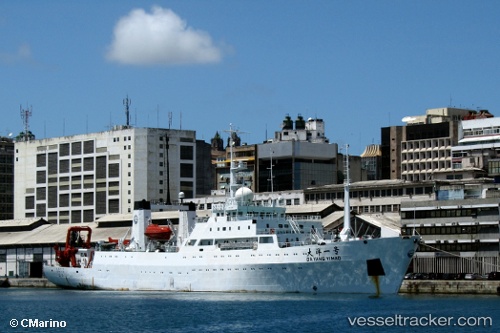
 DA YANG YI HAO
Current Status
Where is the vessel?
DA YANG YI HAO is currently in Near Qingdao, based on AIS data received less than 1h ago.
Latest AIS update:
Current position: 36.09259° N, 120.52248° E (Near Qingdao)
Average speed (last 7 days): Loading…
Average speed (last 30 days): Loading…
Vessel profile: DA YANG YI HAO is a Research/Survey Vessel with dimensions m x m.
This page combines live AIS, route history, probable destination signals, nearby traffic, and port activity for practical vessel monitoring.
The current position of vessel DA YANG YI HAO is 36.09259 lat / 120.52248 lng. Updated: 2026-05-02 10:28:04 UTCNearest reference points:
- Near Qingdao
- Near Xianlang
- 13 nm SE of Xianlang
Currently sailing under the flag of China ![]()
Details:
Live Vessel DA YANG YI HAO Analytics (details, animations, etc.)
Recent AIS points (UTC):
2026-05-02 07:22:05 UTC · 36.09260, 120.52248 · SOG 0 kn · COG -1°2026-05-02 07:28:06 UTC · 36.09259, 120.52250 · SOG 0 kn · COG -1°
2026-05-02 09:52:06 UTC · 36.09257, 120.52249 · SOG 0 kn · COG -1°
2026-05-02 10:28:04 UTC · 36.09259, 120.52248 · SOG 0 kn · COG -1°