 vesseltracker.com
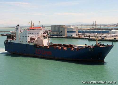
 Chodziez
Current Status
Where is the vessel?
Chodziez is currently in 367 nm NE of Port Mathurin, based on AIS data received less than 1h ago.
Latest AIS update:
Current position: 15.81494° S, 68.38583° E (367 nm NE of Port Mathurin)
Average speed (last 7 days): Loading…
Average speed (last 30 days): Loading…
Vessel profile: Chodziez is a Ro Ro Cargo Ship with dimensions 148m x 24m.
This page combines live AIS, route history, probable destination signals, nearby traffic, and port activity for practical vessel monitoring.
The current position of vessel Chodziez is -15.81494 lat / 68.38583 lng. Updated: 2026-05-13 21:25:46 UTCNearest reference points:
- Open sea, approx. 402 nm off the nearest listed port
- Open sea, approx. 403 nm off the nearest listed port
- Open sea, approx. 404 nm off the nearest listed port
Currently sailing under the flag of Malta ![]()
Chodziez built in 1988 year
Deadweight:
8044 tDetails:
Live Vessel Chodziez Analytics (details, animations, etc.)
Recent AIS points (UTC):
2026-05-13 18:14:12 UTC · -16.09279, 67.91627 · SOG 9.9 kn · COG 58°2026-05-13 19:08:55 UTC · -16.01426, 68.04992 · SOG 10.1 kn · COG 57°
2026-05-13 19:50:16 UTC · -15.95401, 68.15157 · SOG 9.9 kn · COG 59°
2026-05-13 21:25:46 UTC · -15.81494, 68.38583 · SOG 9.8 kn · COG 60°