 vesseltracker.com
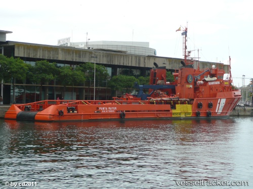
 Punta Mayor
Current Status
Where is the vessel?
Punta Mayor is currently in Near Gelves, based on AIS data received about 2h ago.
Latest AIS update:
Current position: 37.33971° N, 5.99578° W (Near Gelves)
Average speed (last 7 days): Loading…
Average speed (last 30 days): Loading…
Vessel profile: Punta Mayor is a Offshore Tug Supply Ship with dimensions 60m x 12m.
This page combines live AIS, route history, probable destination signals, nearby traffic, and port activity for practical vessel monitoring.
The current position of vessel Punta Mayor is 37.33971 lat / -5.99578 lng. Updated: 2026-05-15 01:12:44 UTCNearest reference points:
- Near Trebujena
- Near CHIPIONA
- Near El Puerto de Santa María
Currently sailing under the flag of Spain ![]()
Punta Mayor built in 1984 year
Deadweight:
1218 tDetails:
Live Vessel Punta Mayor Analytics (details, animations, etc.)
Recent AIS points (UTC):
2026-05-14 22:12:44 UTC · 37.33971, -5.99578 · SOG 0 kn · COG -1°2026-05-14 22:54:41 UTC · 37.33971, -5.99578 · SOG 0 kn · COG -1°
2026-05-14 23:42:42 UTC · 37.33971, -5.99578 · SOG 0 kn · COG -1°
2026-05-15 01:12:44 UTC · 37.33971, -5.99578 · SOG 0 kn · COG -1°