 vesseltracker.com
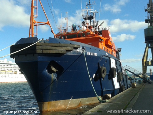
 Ria De Vigo
Current Status
Where is the vessel?
Ria De Vigo is currently in Near Pobra do Caraminal, based on AIS data received less than 1h ago.
Latest AIS update:
Current position: 42.60542° N, 8.93113° W (Near Pobra do Caraminal)
Average speed (last 7 days): Loading…
Average speed (last 30 days): Loading…
Vessel profile: Ria De Vigo is a Offshore Tug Supply Ship with dimensions 68m x 14m.
This page combines live AIS, route history, probable destination signals, nearby traffic, and port activity for practical vessel monitoring.
The current position of vessel Ria De Vigo is 42.60542 lat / -8.93113 lng. Updated: 2026-05-14 11:33:56 UTCNearest reference points:
- Near Portosin
- Near Corujo
- Near Vigo
Currently sailing under the flag of Spain ![]()
Ria De Vigo built in 1985 year
Deadweight:
1879 tDetails:
Live Vessel Ria De Vigo Analytics (details, animations, etc.)
Recent AIS points (UTC):
2026-05-14 07:21:40 UTC · 42.60542, -8.93111 · SOG 0 kn · COG 171°2026-05-14 09:42:48 UTC · 42.60541, -8.93113 · SOG 0 kn · COG 172°
2026-05-14 10:37:14 UTC · 42.60543, -8.93113 · SOG 0 kn · COG 172°
2026-05-14 11:33:56 UTC · 42.60542, -8.93113 · SOG 0 kn · COG 171°