 vesseltracker.com
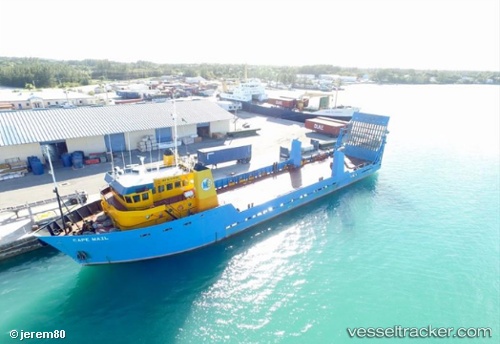
Cape Mail
Current StatusWhere is the vessel?
Cape Mail is currently in Near Nassau, based on AIS data received less than 1h ago.
Latest AIS update:
Current position: 25.07854° N, 77.32424° W (Near Nassau)
Average speed (last 7 days): Loading…
Average speed (last 30 days): Loading…
Vessel profile: Cape Mail is a Offshore Tug Supply Ship with dimensions 12m x 67m.
This page combines live AIS, route history, probable destination signals, nearby traffic, and port activity for practical vessel monitoring.
The current position of vessel Cape Mail is 25.07854 lat / -77.32424 lng. Updated: 2026-05-17 07:42:20 UTCNearest reference points:
- Near Nassau
- Near Lyford Cay
- 11 nm S of Lyford Cay
Details:
Live Vessel Cape Mail Analytics (details, animations, etc.)
Recent AIS points (UTC):
2026-05-17 05:15:19 UTC · 25.07856, -77.32425 · SOG 0 kn · COG 7°2026-05-17 05:40:41 UTC · 25.07833, -77.32333 · SOG 0 kn · COG -1°
2026-05-17 07:31:02 UTC · 25.07833, -77.32333 · SOG 0 kn · COG -1°
2026-05-17 07:42:20 UTC · 25.07854, -77.32424 · SOG 0 kn · COG 7°