 vesseltracker.com
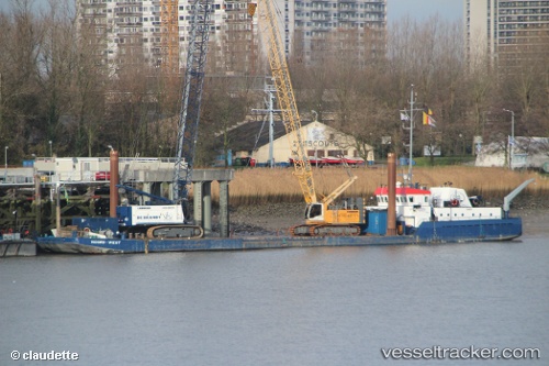
 Noord west
Current Status
Where is the vessel?
Noord west is currently in Near Antwerp, based on AIS data received less than 1h ago.
Latest AIS update:
Current position: 51.24983° N, 4.39160° E (Near Antwerp)
Average speed (last 7 days): Loading…
Average speed (last 30 days): Loading…
Vessel profile: Noord west is a Deck Cargo Ship with dimensions 60m x 12m.
This page combines live AIS, route history, probable destination signals, nearby traffic, and port activity for practical vessel monitoring.
The current position of vessel Noord west is 51.24983 lat / 4.39160 lng. Updated: 2026-05-15 17:51:53 UTCNearest reference points:
- Near Antwerp
- Near Kruibeke
- Near Kallo
Currently sailing under the flag of Belgium ![]()
Noord west built in 1985 year
Deadweight:
1122 tDetails:
Live Vessel Noord west Analytics (details, animations, etc.)
Recent AIS points (UTC):
2026-05-15 13:27:59 UTC · 51.24974, 4.39163 · SOG 0.3 kn · COG -1°2026-05-15 15:31:40 UTC · 51.24992, 4.39157 · SOG 0.4 kn · COG -1°
2026-05-15 16:37:12 UTC · 51.24987, 4.39163 · SOG 0.9 kn · COG -1°
2026-05-15 17:51:53 UTC · 51.24983, 4.39160 · SOG 0.4 kn · COG -1°