 vesseltracker.com
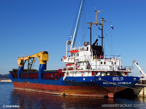
 Ranyus Sea
Current Status
Where is the vessel?
Ranyus Sea is currently in 19 nm W of Dokdo, based on AIS data received about 3d ago.
Latest AIS update:
Current position: 37.19721° N, 131.45758° E (19 nm W of Dokdo)
Average speed (last 7 days): Loading…
Average speed (last 30 days): Loading…
Vessel profile: Ranyus Sea is a General Cargo Ship with dimensions 98m x 13m.
This page combines live AIS, route history, probable destination signals, nearby traffic, and port activity for practical vessel monitoring.
The current position of vessel Ranyus Sea is 37.19721 lat / 131.45758 lng. Updated: 2026-05-10 16:36:01 UTCNearest reference points:
- 33 nm NE of Ulleung-gun
- 37 nm NW of NAKANOSHIMA
- 67 nm W of NAKANOSHIMA
Currently sailing under the flag of Sierra Leone ![]()
Ranyus Sea built in 1985 year
Deadweight:
3732 tDetails:
Live Vessel Ranyus Sea Analytics (details, animations, etc.)
Recent AIS points (UTC):
2026-05-10 16:36:01 UTC · 37.19721, 131.45758 · SOG 12.6 kn · COG 14°2026-05-10 16:36:01 UTC · 37.19721, 131.45758 · SOG 12.6 kn · COG 14°
2026-05-10 16:36:01 UTC · 37.19721, 131.45758 · SOG 12.6 kn · COG 14°
2026-05-10 16:36:01 UTC · 37.19721, 131.45758 · SOG 12.6 kn · COG 14°