 BROTHERS WAY
Current Status
Where is the vessel?
BROTHERS WAY is currently in Near MIDIA, based on AIS data received about 14h ago.
Latest AIS update:
Current position: 44.34266° N, 28.68502° E (Near MIDIA)
Average speed (last 7 days): Loading…
Average speed (last 30 days): Loading…
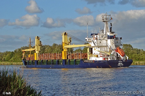
Vessel profile: BROTHERS WAY is a General Cargo Ship with dimensions 105m x 16m.
This page combines live AIS, route history, probable destination signals, nearby traffic, and port activity for practical vessel monitoring.
The current position of vessel BROTHERS WAY is 44.34266 lat / 28.68502 lng. Updated: 2026-05-23 11:37:30 UTCNearest reference points:
- Near MIDIA
- Near Constanta
- Near Ovidiu
Currently sailing under the flag of St.Kitts and Nevis ![]()
BROTHERS WAY built in 1985 year
Deadweight:
4407 tDetails:
Live Vessel BROTHERS WAY Analytics (details, animations, etc.)
Recent AIS points (UTC):
2026-05-23 07:44:26 UTC · 44.33615, 28.67709 · SOG 0.3 kn · COG 1°2026-05-23 09:32:25 UTC · 44.33614, 28.67709 · SOG 0.1 kn · COG -1°
2026-05-23 10:11:25 UTC · 44.33617, 28.67713 · SOG 0.1 kn · COG -1°
2026-05-23 11:37:30 UTC · 44.34266, 28.68502 · SOG 0.2 kn · COG -1°