 vesseltracker.com
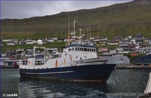
Safir
Current StatusWhere is the vessel?
Safir is currently in 40 nm SE of Thorshavn, based on AIS data received about 1h ago.
Latest AIS update:
Current position: 61.73110° N, 4.77442° W (40 nm SE of Thorshavn)
Average speed (last 7 days): Loading…
Average speed (last 30 days): Loading…
Vessel profile: Safir is a Fishing Vessel with dimensions 8m x 32m.
This page combines live AIS, route history, probable destination signals, nearby traffic, and port activity for practical vessel monitoring.
The current position of vessel Safir is 61.73110 lat / -4.77442 lng. Updated: 2026-04-27 15:37:59 UTCNearest reference points:
- Near FUGLAFJORDUR
- 20 nm S of Vágur
- 36 nm NW of Ham Voe, Foula
Details:
Live Vessel Safir Analytics (details, animations, etc.)
Recent AIS points (UTC):
2026-04-27 10:08:04 UTC · 61.78833, -4.76667 · SOG 3 kn · COG -1°2026-04-27 12:00:03 UTC · 61.86962, -4.65677 · SOG 3.5 kn · COG 349°
2026-04-27 13:42:00 UTC · 61.83318, -4.68468 · SOG 3.9 kn · COG 212°
2026-04-27 15:37:59 UTC · 61.73110, -4.77442 · SOG 8.3 kn · COG 206°