 vesseltracker.com
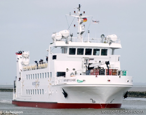
 Wangerooge
Current Status
Where is the vessel?
Wangerooge is currently in Near Wangerooge, based on AIS data received less than 1h ago.
Latest AIS update:
Current position: 53.75400° N, 7.86358° E (Near Wangerooge)
Average speed (last 7 days): Loading…
Average speed (last 30 days): Loading…
Vessel profile: Wangerooge is a Passenger Ship with dimensions 44m x 10m.
This page combines live AIS, route history, probable destination signals, nearby traffic, and port activity for practical vessel monitoring.
The current position of vessel Wangerooge is 53.75400 lat / 7.86358 lng. Updated: 2026-03-29 06:11:26 UTCNearest reference points:
- Near Wangerooge
- Near Horumersiel
- Near HOOKSIEL
Currently sailing under the flag of Germany ![]()
Wangerooge built in 1985 year
Deadweight:
99 tDetails:
Live Vessel Wangerooge Analytics (details, animations, etc.)
Recent AIS points (UTC):
2026-03-29 00:15:46 UTC · 53.77471, 7.86726 · SOG 0 kn · COG 198°2026-03-29 01:21:40 UTC · 53.77476, 7.86724 · SOG 0 kn · COG 198°
2026-03-29 04:15:35 UTC · 53.77472, 7.86725 · SOG 0 kn · COG 198°
2026-03-29 06:11:26 UTC · 53.75400, 7.86358 · SOG 10.3 kn · COG 192°