 vesseltracker.com
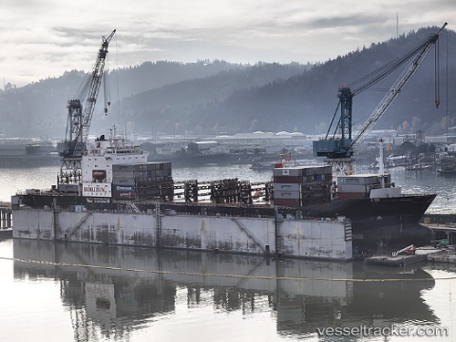
 Matson Tacoma
Current Status
Where is the vessel?
Matson Tacoma is currently in Near Dutch Harbor, based on AIS data received about 1h ago.
Latest AIS update:
Current position: 53.90167° N, 166.52834° W (Near Dutch Harbor)
Average speed (last 7 days): Loading…
Average speed (last 30 days): Loading…
Vessel profile: Matson Tacoma is a Container Ship with dimensions 216m x 24m.
This page combines live AIS, route history, probable destination signals, nearby traffic, and port activity for practical vessel monitoring.
The current position of vessel Matson Tacoma is 53.90167 lat / -166.52834 lng. Updated: 2026-05-15 19:58:51 UTCNearest reference points:
- Near Dutch Harbor
Currently sailing under the flag of USA ![]()
Matson Tacoma built in 1987 year
Deadweight:
20668 tDetails:
Live Vessel Matson Tacoma Analytics (details, animations, etc.)
Recent AIS points (UTC):
2026-05-15 16:28:33 UTC · 53.90181, -166.52940 · SOG 0 kn · COG 223°2026-05-15 17:28:35 UTC · 53.90184, -166.52937 · SOG 0 kn · COG 222°
2026-05-15 19:43:51 UTC · 53.90167, -166.52834 · SOG 0 kn · COG -1°
2026-05-15 19:58:51 UTC · 53.90167, -166.52834 · SOG 0 kn · COG -1°