 vesseltracker.com
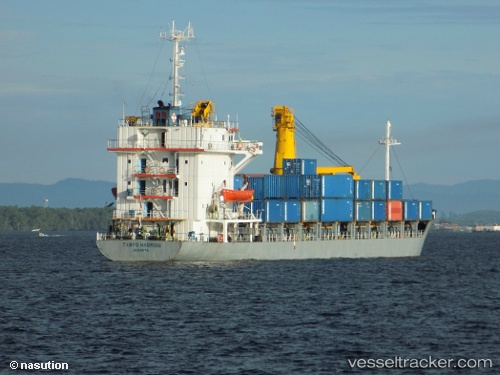
Mv.tanto Harmoni
Current StatusWhere is the vessel?
Mv.tanto Harmoni is currently in 37 nm NE of Camar Marine Terminal, based on AIS data received about 31d ago.
Latest AIS update:
Current position: 6.04538° S, 113.56110° E (37 nm NE of Camar Marine Terminal)
Average speed (last 7 days): Loading…
Average speed (last 30 days): Loading…
Vessel profile: Mv.tanto Harmoni is a General Cargo Ship with dimensions 18m x 96m.
This page combines live AIS, route history, probable destination signals, nearby traffic, and port activity for practical vessel monitoring.
The current position of vessel Mv.tanto Harmoni is -6.04538 lat / 113.56110 lng. Updated: 2026-04-16 19:51:27 UTCNearest reference points:
- 27 nm NE of Camar Marine Terminal
- 25 nm NE of Camar Marine Terminal
- 30 nm NW of Sumenep
Details:
Live Vessel Mv.tanto Harmoni Analytics (details, animations, etc.)
Recent AIS points (UTC):
2026-04-16 19:51:27 UTC · -6.04538, 113.56110 · SOG 4.6 kn · COG -1°