 vesseltracker.com
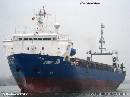
 Ahmet Onel
Current Status
Where is the vessel?
Ahmet Onel is currently in 11 nm NW of KENDARI, based on AIS data received about 19d ago.
Latest AIS update:
Current position: 3.82414° S, 122.49227° E (11 nm NW of KENDARI)
Average speed (last 7 days): Loading…
Average speed (last 30 days): Loading…
Vessel profile: Ahmet Onel is a General Cargo Ship with dimensions 115m x 16m.
This page combines live AIS, route history, probable destination signals, nearby traffic, and port activity for practical vessel monitoring.
The current position of vessel Ahmet Onel is -3.82414 lat / 122.49227 lng. Updated: 2026-04-25 08:26:42 UTCNearest reference points:
- 11 nm NW of KENDARI
- 45 nm N of KENDARI
- Near Labuan
Currently sailing under the flag of Panama ![]()
Ahmet Onel built in 1987 year
Deadweight:
6862 tDetails:
Live Vessel Ahmet Onel Analytics (details, animations, etc.)
Recent AIS points (UTC):
2026-04-25 08:26:42 UTC · -3.82414, 122.49227 · SOG 1.5 kn · COG -1°