 vesseltracker.com
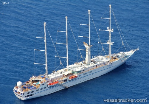
Wind Star
Current StatusWhere is the vessel?
Wind Star is currently in Near KUSADASI, based on AIS data received less than 1h ago.
Latest AIS update:
Current position: 37.86324° N, 27.25335° E (Near KUSADASI)
Average speed (last 7 days): Loading…
Average speed (last 30 days): Loading…
Vessel profile: Wind Star is a Cruise Ship with dimensions 18m x 135m.
This page combines live AIS, route history, probable destination signals, nearby traffic, and port activity for practical vessel monitoring.
The current position of vessel Wind Star is 37.86324 lat / 27.25335 lng. Updated: 2026-05-18 07:49:56 UTCNearest reference points:
- Near KUSADASI
- Near PYTHAGOREIO
- Near DIDIM
Details:
Live Vessel Wind Star Analytics (details, animations, etc.)
Recent AIS points (UTC):
2026-05-18 04:10:53 UTC · 37.86327, 27.25333 · SOG 0 kn · COG 318°2026-05-18 05:52:58 UTC · 37.86325, 27.25336 · SOG 0 kn · COG 318°
2026-05-18 07:10:56 UTC · 37.86323, 27.25337 · SOG 0 kn · COG 318°
2026-05-18 07:49:56 UTC · 37.86324, 27.25335 · SOG 0 kn · COG 318°