 vesseltracker.com
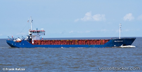
 Celtica Hav
Current Status
Where is the vessel?
Celtica Hav is currently in Near Santander, based on AIS data received less than 1h ago.
Latest AIS update:
Current position: 43.44856° N, 3.82228° W (Near Santander)
Average speed (last 7 days): Loading…
Average speed (last 30 days): Loading…
Vessel profile: Celtica Hav is a Multi Purpose Carrier with dimensions 82m x 11m.
This page combines live AIS, route history, probable destination signals, nearby traffic, and port activity for practical vessel monitoring.
The current position of vessel Celtica Hav is 43.44856 lat / -3.82228 lng. Updated: 2026-05-14 23:46:31 UTCNearest reference points:
- Near LAREDO
- Near Mazcuerras
- Near Zierbena
Currently sailing under the flag of Bahamas ![]()
Celtica Hav built in 1984 year
Deadweight:
1720 tDetails:
Live Vessel Celtica Hav Analytics (details, animations, etc.)
Recent AIS points (UTC):
2026-05-14 19:50:01 UTC · 43.57472, -3.76409 · SOG 6.1 kn · COG 181°2026-05-14 22:22:22 UTC · 43.44857, -3.82218 · SOG 0 kn · COG 97°
2026-05-14 22:55:28 UTC · 43.44854, -3.82221 · SOG 0 kn · COG 97°
2026-05-14 23:46:31 UTC · 43.44856, -3.82228 · SOG 0 kn · COG 97°