 vesseltracker.com
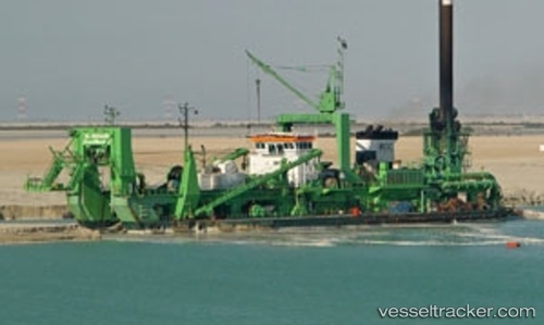
Al Mahaar
Current StatusWhere is the vessel?
Al Mahaar is currently in Near GLADSTONE, based on AIS data received about 350d ago.
Latest AIS update:
Current position: 23.77797° S, 151.19115° E (Near GLADSTONE)
Average speed (last 7 days): Loading…
Average speed (last 30 days): Loading…
Vessel profile: Al Mahaar is a Dredger with dimensions 29m x 103m.
This page combines live AIS, route history, probable destination signals, nearby traffic, and port activity for practical vessel monitoring.
The current position of vessel Al Mahaar is -23.77797 lat / 151.19115 lng. Updated: 2025-05-14 07:02:19 UTCNearest reference points:
- Near Gladstone Harbor
- Near Boyne Island
- Near ROSSLYN
Details:
Live Vessel Al Mahaar Analytics (details, animations, etc.)
Recent AIS points (UTC):
2025-05-14 07:02:19 UTC · -23.77797, 151.19115 · SOG 0 kn · COG -1°