 vesseltracker.com
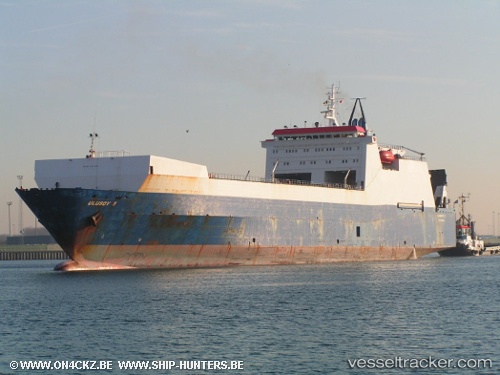
 Ulusoy 5
Current Status
Where is the vessel?
Ulusoy 5 is currently in 34 nm S of Villafranca Tirrena, based on AIS data received about 2h ago.
Latest AIS update:
Current position: 35.67333° N, 15.44667° E (34 nm S of Villafranca Tirrena)
Average speed (last 7 days): Loading…
Average speed (last 30 days): Loading…
Vessel profile: Ulusoy 5 is a Ro Ro Cargo Ship with dimensions 165m x 165m.
This page combines live AIS, route history, probable destination signals, nearby traffic, and port activity for practical vessel monitoring.
The current position of vessel Ulusoy 5 is 35.67333 lat / 15.44667 lng. Updated: 2026-05-16 15:50:29 UTCNearest reference points:
- 18 nm E of Il-Kappara
- 13 nm E of Il-Kappara
- Near Xghajra
Currently sailing under the flag of Turkey ![]()
Ulusoy 5 built in 1987 year
Deadweight:
14103 tDetails:
Live Vessel Ulusoy 5 Analytics (details, animations, etc.)
Recent AIS points (UTC):
2026-05-16 14:06:14 UTC · 35.80717, 14.94943 · SOG 14.8 kn · COG 104°2026-05-16 14:39:27 UTC · 35.76232, 15.10778 · SOG 15 kn · COG 105°
2026-05-16 15:50:29 UTC · 35.67333, 15.44667 · SOG 14 kn · COG -1°
2026-05-16 15:50:29 UTC · 35.67333, 15.44667 · SOG 14 kn · COG -1°