 vesseltracker.com
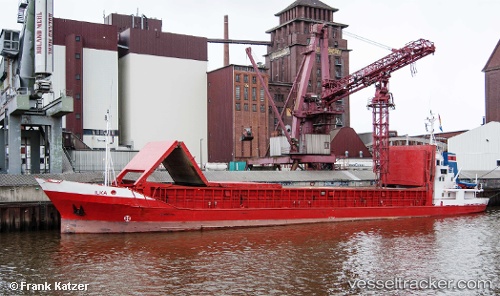
 Ilka
Ilka
Current Status
Where is the vessel?
Ilka is currently in Near HUSUM, based on AIS data received less than 1h ago.
Latest AIS update:
Current position: 54.47280° N, 9.04193° E (Near HUSUM)
Average speed (last 7 days): Loading…
Average speed (last 30 days): Loading…
Vessel profile: Ilka is a Multi Purpose Carrier with dimensions 72m x 11m.
This page combines live AIS, route history, probable destination signals, nearby traffic, and port activity for practical vessel monitoring.
The current position of vessel Ilka is 54.4728 lat / 9.04193 lng. Updated: 2026-05-01 20:23:12 UTCNearest reference points:
- Near Flensburg
- Near Busdorf bei Schleswig
- Near Wees
Currently sailing under the flag of Germany ![]()
Ilka built in 1985 year
Deadweight:
1300 tDetails:
Live Vessel Ilka Analytics (details, animations, etc.)
Recent AIS points (UTC):
2026-05-01 15:53:12 UTC · 54.47280, 9.04192 · SOG 0 kn · COG 243°2026-05-01 17:47:11 UTC · 54.47290, 9.04201 · SOG 0 kn · COG 243°
2026-05-01 19:50:10 UTC · 54.47280, 9.04187 · SOG 0 kn · COG 243°
2026-05-01 20:23:12 UTC · 54.47280, 9.04193 · SOG 0 kn · COG 243°