 vesseltracker.com
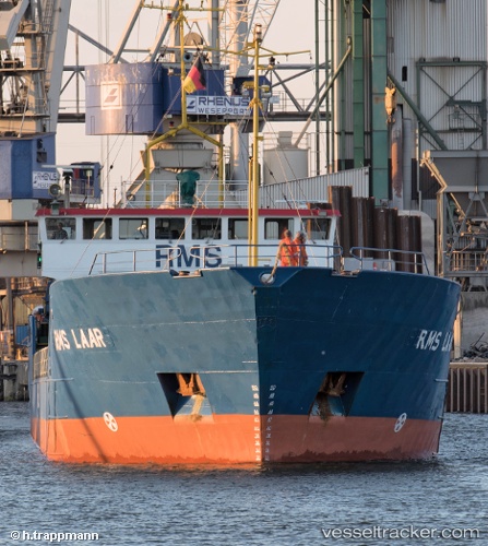
 LAAR
LAAR
Current Status
Where is the vessel?
LAAR is currently in Near Nowy Port/Gdansk, based on AIS data received about 1h ago.
Latest AIS update:
Current position: 54.40756° N, 18.65747° E (Near Nowy Port/Gdansk)
Average speed (last 7 days): Loading…
Average speed (last 30 days): Loading…
Vessel profile: LAAR is a General Cargo with dimensions m x m.
This page combines live AIS, route history, probable destination signals, nearby traffic, and port activity for practical vessel monitoring.
The current position of vessel LAAR is 54.40756 lat / 18.65747 lng. Updated: 2026-05-15 17:51:41 UTCNearest reference points:
- Near Nowy Port/Gdansk
- Near Sopot
- Near Górki Zachodnie
Currently sailing under the flag of Antigua and Barbuda ![]()
Details:
Live Vessel LAAR Analytics (details, animations, etc.)
Recent AIS points (UTC):
2026-05-15 13:27:44 UTC · 54.40756, 18.65752 · SOG 0 kn · COG 239°2026-05-15 15:30:42 UTC · 54.40756, 18.65751 · SOG 0 kn · COG 239°
2026-05-15 16:36:42 UTC · 54.40755, 18.65751 · SOG 0 kn · COG 238°
2026-05-15 17:51:41 UTC · 54.40756, 18.65747 · SOG 0 kn · COG 239°