 vesseltracker.com
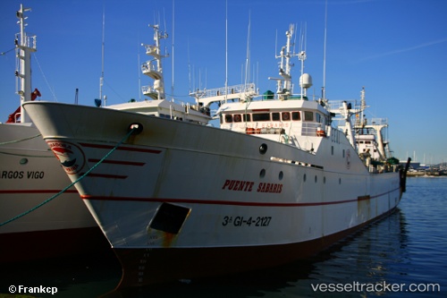
 PUENTE SABARIS
Current Status
Where is the vessel?
PUENTE SABARIS is currently in 93 nm W of Stompneus, based on AIS data received less than 1h ago.
Latest AIS update:
Current position: 31.75827° S, 16.13100° E (93 nm W of Stompneus)
Average speed (last 7 days): Loading…
Average speed (last 30 days): Loading…
Vessel profile: PUENTE SABARIS is a Fishing Vessel with dimensions 11m x 70m.
This page combines live AIS, route history, probable destination signals, nearby traffic, and port activity for practical vessel monitoring.
The current position of vessel PUENTE SABARIS is -31.75827 lat / 16.13100 lng. Updated: 2026-05-14 03:40:56 UTCNearest reference points:
- 167 nm SW of Koiingnaas
- 154 nm W of Koiingnaas
- Near Saint Helena Bay
Currently sailing under the flag of South Africa ![]()
PUENTE SABARIS built in 1986 year
Deadweight:
1216 tDetails:
Live Vessel PUENTE SABARIS Analytics (details, animations, etc.)
Recent AIS points (UTC):
2026-05-13 23:54:19 UTC · -31.98667, 16.24000 · SOG 3 kn · COG -1°2026-05-14 01:19:17 UTC · -31.90165, 16.20148 · SOG 4.1 kn · COG 328°
2026-05-14 01:29:37 UTC · -31.89142, 16.19527 · SOG 3.9 kn · COG 320°
2026-05-14 03:40:56 UTC · -31.75827, 16.13100 · SOG 3.3 kn · COG 336°